Hotel Booking

Friday, December 18, 2009

Root Bridges of India turism in india

Root Bridges of India turism in india 

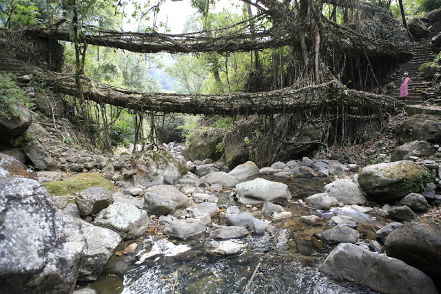
In the depths of northeastern India , in one of the wettest places on earth, bridges aren't built -- they're grown.
turism in india
turism in india
turism in india
Grown from the roots of a rubber tree, the Khasis people of Cherapunjee use betel-tree trunks, sliced down the middle and hollowed out, to create "root-guidance systems." When they reach the other side of the river, they're allowed to take root in the soil. Given enough time a sturdy, living bridge is produced.
turism in india
The root bridges, some of which are over a hundred feet long, take ten to fifteen years to become fully functional, but they're extraordinarily strong. Some can support the weight of 50 or more people at once.
One of the most unique root structures of Cherrapunjee is known as the " Umshiang Double-Decker Root Bridge ." It consists of two bridges stacked one over the other!
turism in india
turism in india
turism in india
Because the bridges are alive and still growing, they actually gain strength over time, and some of the ancient root bridges used daily by the people of the villages around Cherrapunjee may be well over 500 years old.
turism in india

But these are not the only bridges built from growing plants. Japan too, has its own form of living bridges.

These are The Vine Bridges of Iya Valley .......

turism in india

One of Japan 's three "hidden" valleys, West Iya is home to the kind of misty gorges, clear rivers, and thatched roofs one imagines in the Japan of centuries ago. To get across the Iya River that runs through the rough valley terrain, bandits, warriors and refugees created a very special - if slightly unsteady - bridge made of vines.
turism in india
This is a picture from the 1880s of one of the original vine bridges.
turism in india
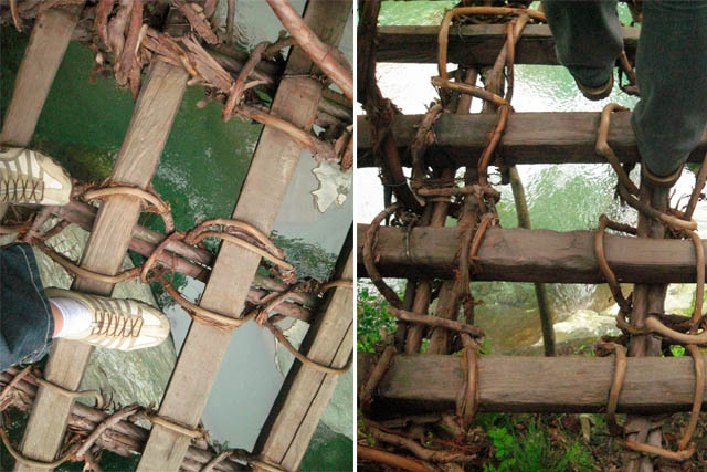
First, two Wisteria vines -- one of the strongest vines known -- were grown to extraordinary lengths from either side of the river. Once the vines had reached a sufficient length they were woven together with planking to create a pliable, durable and, most importantly, living piece of botanical engineering.
turism in india
turism in india
The bridges had no sides, and a Japanese historical source relates that the original vine bridges were so unstable, those attempting to cross them for the first time would often freeze in place, unable to go any farther.
Three of those vine bridges remain in Iya Valley . While some (though apparently not all) of the bridges have been reinforced with wire and side rails, they are still harrowing to cross. More than 140 feet long, with planks set six to eight inches apart and a drop of four-and-a-half stories down to the water, they are not for acrophobes.
turism in india
Some people believe the existing vine bridges were first grown in the 12th century, which would make

them some of the oldest known examples of living architecture in the world.

turism in india

Thursday, December 17, 2009

Forts in Maharashtra

Forts in Maharashtra

Nowhere in the country would you encounter such a profusion of forts. And such variety. Sited on an island, as at Murud-Janjira or guarding the seas as at Bassein, or among the Sahyadri hills, as at Raigad, whose zig-zag walls and rounded bastions sit like a sceptre and crown amidst hills turned mauve.

Most of the forts in Maharashtra whether up in the hills or near the seas are associated with Shivaji --the great Maratha warrior and an equally great fort builder. Moreover, these forts were treated as mini-cities, such as Panhala, which is now a hill station. The concept of the fort-city was, however, not peculiar to Shivaji alone. The Portuguese who came to India as traders and missionaries, built within a century of their coming, Bassein, a garden city to rival many a European capital.

Pratapgarh

Pratapgarh

samadhi of Chatrapati Shivaji Maharaj

samadhi of Chatrapati Shivaji Maharaj

Sinhagad Fort

Sinhagad Fort

Alibaug

Alibaug

Rajgad

Rajgad

Raje

Raje

ShivSamadhi

ShivSamadhi

purandar

purandar

pratapgad

Pratapgad

Lohgad

Lohgad

Janjira

Janjira

Arnala

Arnala


Konark Sun Temple

Konark Sun Temple

Konark (or Konarak) is a small town in the state of Orissa, India, on the Bay of Bengal, sixty-five kilometres from Bhubaneswar.

Konark is the site of the 13th-century Sun Temple (also known as the Black Pagoda), built in black granite by King Narasimhadeva. The temple is one of the most important Brahman sanctuaries, and is a world heritage site. It takes the form of the chariot of Surya, the sun god, and is heavily decorated with stone carving. The temple is now partly in ruins, and a collection of its sculptures is housed in the Sun Temple Museum, which is run by the Archaeological Survey of India. The poet Rabindranath Tagore wrote of Konark: "here the language of stone surpasses the language of man". Konark is also home to an annual dance festival, held every December, devoted to classical Indian dance forms, including the traditional classical dance of Orissa, odissi.

Konark beach is a popular tourist destination, though the waters are deceptively calm. Its main attraction lies in its views of the temple.

Konark Sun Temple
Konark Sun Temple Top

(click on the pictures to to view at high resolution)
Stone Work at Konark


Wheel of Konark


Technorati Tags:

World's Most Amazing Islands

Top 5 World's Most Amazing Islands

Check out these interesting Islands, very interesting info! Includes the Alcatraz Island, Easter Island, Sealand, Surtsey & the Gunkanjima!

Top 5 World's Most Amazing Islands

5. ALCATRAZ ISLAND (USA): home to the first lighthouse on the Pacific Coast
AmazingIslands

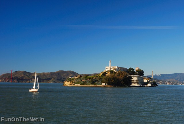
Alcatraz Island (sometimes informally referred to as simply Alcatraz or by its pop-culture name, The Rock) is a small island located in the middle of San Francisco Bay in California, United States. It served as a lighthouse, then a military fortification, then a military prison followed by a federal prison until 1963, when it became a national recreation area. The first European to discover the island was Juan de Ayala in 1775, who charted the San Francisco Bay and named the island "La Isla de los Alcatraces", which means "Island of the Pelicans".
AmazingIslands
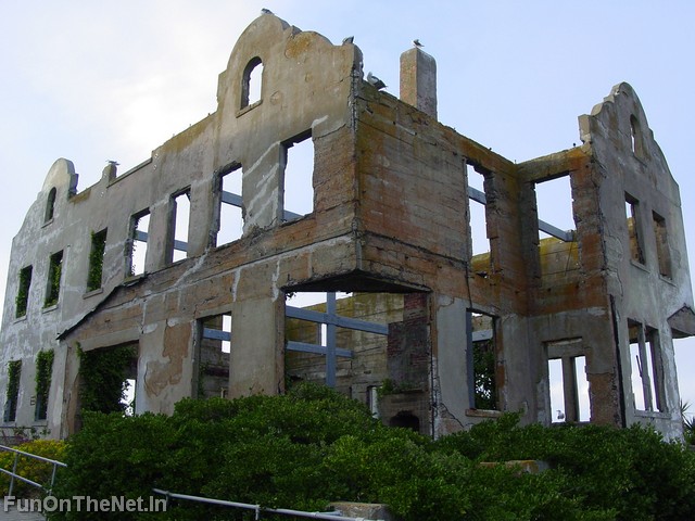
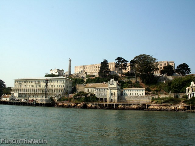
The discovery of gold in California in 1848 brought thousands of ships to San Francisco Bay, creating an urgent need for a navigational lighthouse. In response, Alcatraz lighthouse #1 was erected and lit in the summer of 1853. Because of its natural isolation in the middle of a bay, surrounded by cold water and strong sea currents, Alcatraz was soon considered by the U.S. Army as an ideal location for holding captives. Alcatraz was the Army's first long-term prison, and it was already beginning to build its reputation as a tough detention facility by exposing inmates to harsh conditions and iron fisted discipline. Due to rising operational costs because of its location, the Military Department decided to close this famous prison in 1934, and it was subsequently taken over by the Department of Justice and later became the famous federal prision and finally a recreation area.
AmazingIslands

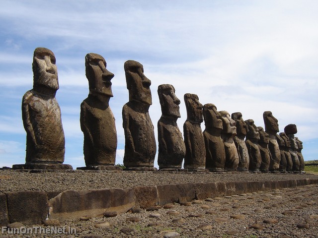
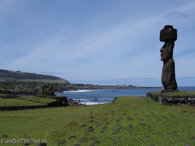
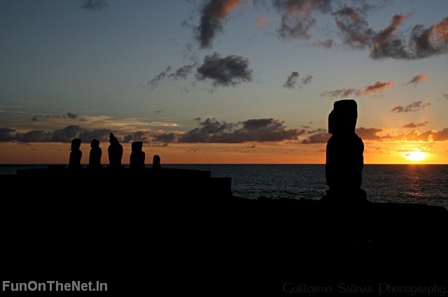
4. EASTER ISLAND (Polynesian triangle, Chile): world heritage site and one of the most isolated inhabited islands in history
AmazingIslands

Easter Island is one of the world's most isolated inhabited islands. It is 3,600 km (2,237 miles) west of continental Chile and 2,075 km (1,290 miles) east of Pitcairn. Nowdays, it is a Chilean-governed island, and is a world heritage site with much of the island protected by the Rapa Nui National Park.
AmazingIslands
First settled by a small party of Polynesians, Easter Island is one of the youngest inhabited territories on Earth, and for most of its history it was the most isolated inhabited territory on Earth. Its inhabitants the Rapanui have endured famines, epidemics, civil war, slave raids and colonialism; have seen their population crash on more than one occasion, and created a cultural legacy that has brought them fame out of all proportion to their numbers.
AmazingIslands

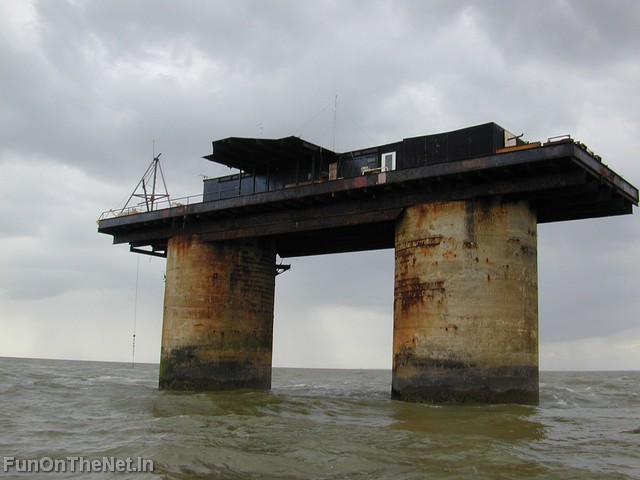
3. SEALAND (Principality): World's smallest island
AmazingIslands

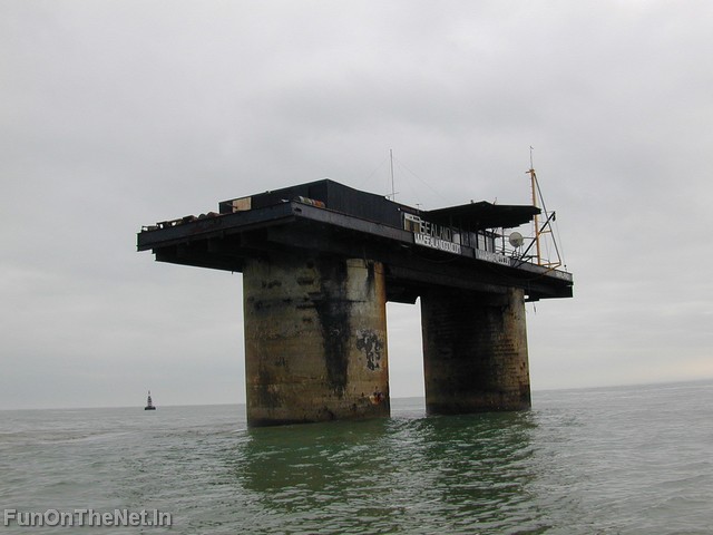
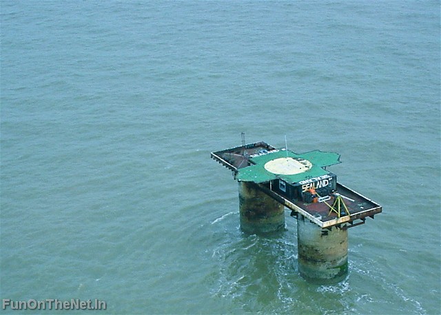
The Principality of Sealand is an island and a micronation located on HM Fort Roughs, a former Maunsell Sea Fort located in the North Sea 10 km (six miles) off the coast of Suffolk, England, in what is claimed as territorial waters using a twelve-nautical-mile radius.
AmazingIslands

Since 1967, the installation has been occupied by associates and family of Paddy Roy Bates, a former radio broadcaster and former British Army Major, who claims that it is a sovereign and independent state. Critics, as well as court rulings in the United States and in Germany, have claimed that Roughs Tower has always remained the property of the United Kingdom, a view that is disputed by the Bates family. The population of the facility rarely exceeds ten, and its habitable area is 550 m2 (5920 sq ft).
Sealand's claims to sovereignty and legitimacy are not recognised by any country, yet it is sometimes cited in debates as an interesting case study of how various principles of international law can be applied to a territorial dispute.
AmazingIslands

2. SURTSEY (Iceland): The emerging island
AmazingIslands

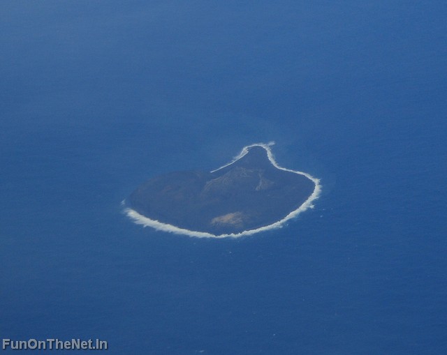
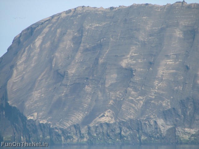
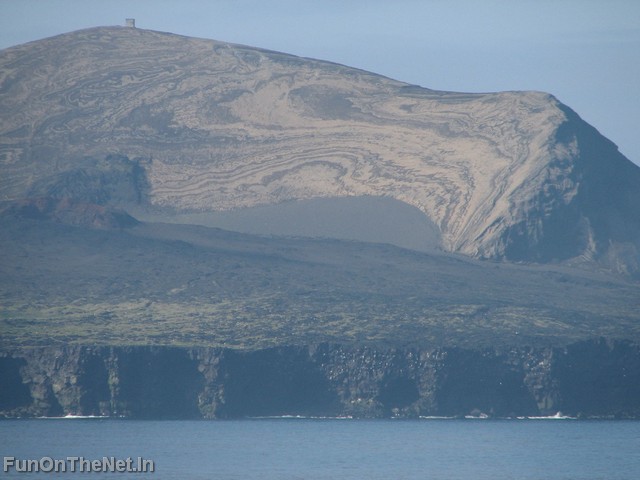
Off the coast of Iceland on the morning of 14 November 1963, the crew of a lone fishing trawler spotted an alarming sight. Off to the southwest of the Ísleifur II, a column of dark smoke was rising from the water. Concerned that it could be another boat on fire, the captain directed his vessel towards the scene. Once there, however, they found not a boat but a series of violent explosions producing ash. This was an unmistakable indication of a volcanic eruption taking place underwater, close to the surface. Very aware of the potential danger but eager to watch, the crew kept their boat nearby. It was indeed a remarkable event that they would witness a small part of over the course of that morning: the formation of a brand-new island.
AmazingIslands
Although now quite visible, the eruption lasted for much, much longer than the Ísleifur II would have been able to watch. After several days, the volcano had broken the water's surface, forming an island over 500 meters long and 45 meters tall. Even though the rough tides of the North Atlantic might have soon eroded the new island away, it was named Surtsey, meaning 'Surtur's island' - Surtur (or Surtr) being a fire giant of Norse mythology. The island proved to be tenacious, however. The eruption was ongoing and Surtsey increased in size more quickly than the ocean could wear it down. In the meantime two other nearby volcanic eruptions produced the beginnings of islands, but neither lasted very long. By April 1964, though, the most violent parts of the eruption were over and Surtsey remained.
AmazingIslands

1. GUNKANJIMA (Japan): the Ghost (and forbidden) Island
AmazingIslands

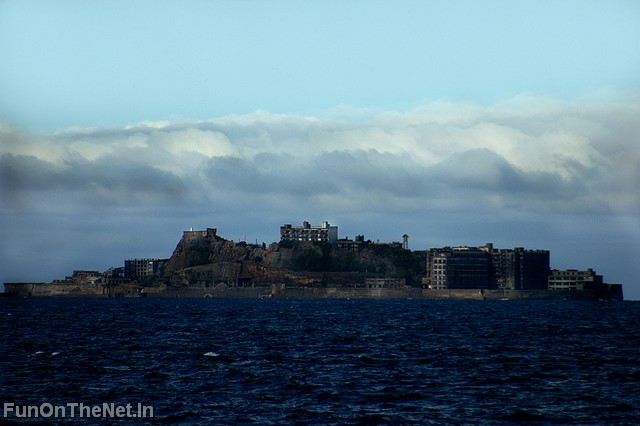
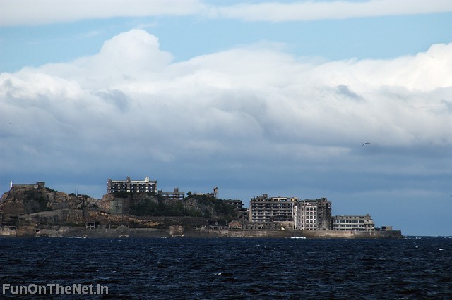
Gunkanjima is one among 505 uninhabited islands in the Nagasaki Prefecture about 15 kilometers from Nagasaki itself. The island was populated from 1887 to 1974 as a coal mining facility. The island's most notable features are the abandoned concrete buildings and the sea wall surrounding it. It is known for its coal mines and their operation during the industrialization of Japan. Mitsubishi bought the island in 1890 and began the project, the aim of which was retrieving coal from the bottom of the sea. They built Japan's first large concrete building, a block of apartments in 1916 to accommodate their burgeoning ranks of workers, and to protect against typhoon destruction.
AmazingIslands

Gunkanjima is one among 505 uninhabited islands in the Nagasaki Prefecture about 15 kilometers from Nagasaki itself. The island was populated from 1887 to 1974 as a coal mining facility. The island's most notable features are the abandoned concrete buildings and the sea wall surrounding it. It is known for its coal mines and their operation during the industrialization of Japan. Mitsubishi bought the island in 1890 and began the project, the aim of which was retrieving coal from the bottom of the sea. They built Japan's first large concrete building, a block of apartments in 1916 to accommodate their burgeoning ranks of workers, and to protect against typhoon destruction.
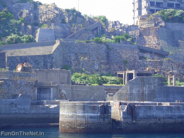
In 1959, its population density was 835 people per hectare for the whole island, or 1,391 per hectare for the residential district, one of the highest population density ever recorded worldwide. As petroleum replaced coal in Japan in the 1960s, coal mines began shutting down all over the country, and Hashima's mines were no exception. Mitsubishi officially announced the closing of the mine in 1974, and today it is empty and bare, which is why it's called the Ghost Island. Travel to Hashima is currently prohibited.
AmazingIslands


Most Extreme Places on Earth

Here is a list of the most extreme places on Earth! From the hottest to the coldest place, from the highest to the lowest and many more!

Extreme Places

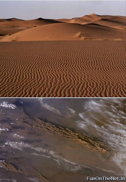
Lut Desert (Iran): hottest place on Earth at 159 °F (71 °C)
Extreme Places
There is a big discussion about the hottest spot on Earth. Many believe it is in Al Azizyah, Libya, with a recorded temperature of 136 degrees Fahrenheit (57.8 Celsius), and the second hottest place being in Death Valley, California, USA, where it got up to 134 Fahrenheit in 1913. But according to other sites, a NASA satellite recorded surface temperatures as high as 71 °C (159 °F) in the Lut desert of Iran, supposedly the hottest temperature ever recorded on the surface of Earth. This region, which covers an area of about 480 kilometers, is called Gandom Beriyan (the toasted wheat).
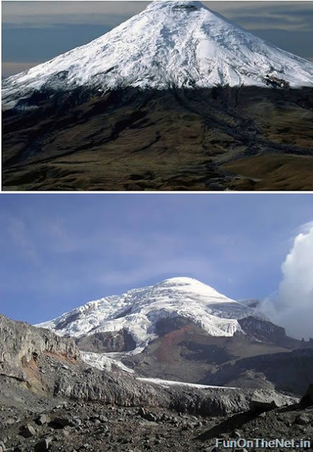
Mt. Chimborazo (Ecuador): highest point above Earht's center at 20,703 feet (6,310 m) above sea level
Extreme Places
Almost everyone knows that Mount Everest is the highest mountain in the world. Climbers from everywhere travel to Everest hoping to earn the distinction of climbing the "World's Highest". The peak of Mount Everest is 8,848 meters (29,028 feet) above sea level. This high elevation gives Mount Everest the distinction of being the mountain with the highest altitude.
But not many people know about Mt Chimborazo in Ecuador with an altitude of 6,310 meters (20,703 feet), which is less than Mount Everest; however, Chimborazo has the distinction of being the highest mountain above Earth's center. This is because Earth is not a sphere - it is an oblate spheroid. As an oblate spheroid, Earth is widest at its equator. Chimborazo is just one degree south of Earth's equator and at that location it is 6,384 kilometers from Earth's center or about 2 kilometers farther from Earth's center than Mount Everest.
Ecuadorians find pride in this interesting fact. Nonetheless, Chimborazo cannot compare in difficulty, lack of oxygen, nor in fame, to Mount Everest. (Link | Photo)
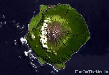
Tristan de Cunha (UK): most remote inhabited archipelago on Earth at 2,000 miles from the nearest continent
Extreme Places
The most remote inhabited island group in the world, Tristan de Cunha in the southern Atlantic Ocean, is so tiny its main island has no airstrip. Home to 272 people sharing just 8 surnames, inhabitants suffer from hereditary complaints like asthma and glaucoma. Annexed by the United Kingdom in the 1800s, the island's inhabitants have a British postal code and, while they can order things online, it takes a very long time for their orders to arrive. But then, that's the trade off for having your own island settlement some 2,000 miles from the nearest continent. (Link | Photo)
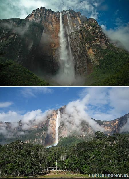
Angels Falls (Venezuela): Earth's highest waterfall with 3230 feet (984 m) in height
Extreme Places
Angel Falls (Salto Ángel) in Venezuela is the highest waterfall in the world. The falls are 3230 feet in height with an uninterrupted drop of 2647 feet. Angel Falls are located on a tributary of the Rio Caroni. The falls are formed when the tributary stream falls from the top of Auyantepui (a tepui is a flat-topped structure surrounded by cliffs - similar to a mesa).
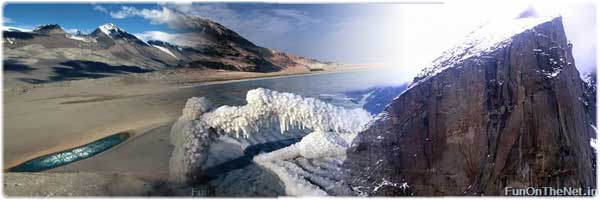
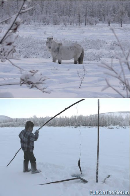
Oymyakon (Russia): coldest inhabited place on Earth at −96.2 °F (−71.2 °C)
Extreme Places
Oymyakon is a village in Oymyakonsky Ulus of the Sakha Republic, Russia, located along the Indigirka River, 30 kilometers (20 mi) northwest of Tomtor on the Kolyma Highway. The population is 800 people. Oymyakon is known as one of the candidates for the Northern Pole of Cold, because on January 26, 1926, a temperature of −71.2 °C (−96.2 °F) was recorded there. This is the lowest recorded temperature for any permanently inhabited location on Earth. It is also the lowest temperature recorded in the Northern hemisphere.
The lowest temperature ever recorded on Earth was -129 °F in 1983, at the Russian Base Vostok in Antarctica.
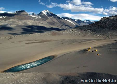
The Dry Valleys (Antarctica): driest place on Earth
Extreme Places
One interior region of the Antarctic is known as The Dry Valleys. These valleys have not seen rainfall in over two million years. With the exception of one valley, whose lakes are briefly filled with water by inland flowing rivers during the summer, the Dry Valleys contain no moisture (water, ice, or snow). The reasons why the Dry Valleys exist are the 200 mph Katabatic down winds which evaporate all moisture. The dry valleys are strange: except for a few steep rocks they are the only continental part of Antarctica devoid of ice. Located in the Trans-Antarctic Range, they correspond to a mountain area where evaporation (or rather, sublimation) is more important than snowfall, thus all the ice disappears, leaving dry barren land.
Another driest place is the Atacama Desert in Chile, some parts of which have received absolutely zero precipitation in centuries. Parts of the Atacama Desert may actually exceed the dryness of most of Antarctica, though data from the latter is insufficient to tell.
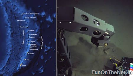
Marianas Trench (Indonesia and Japan): lowest point on Earth at 35,840 feet (10,924 m) below sea level
Extreme Places
Challenger Deep in the Mariana Trench (or Marianas Trench) is the deepest point in Earth's oceans. The bottom there is 10,924 meters (35,840 feet) below sea level. If Mount Everest, the highest mountain on Earth, were placed at this location it would be covered by over one mile of water. The only people to have ever explored this trench were Jacques Piccard and Don Walsh. At the bottom they were seven miles down and all around them eight tons of pressure. They observed fish, shrimp and other creatures living on the bottom of the sea floor. (Link | Photo)
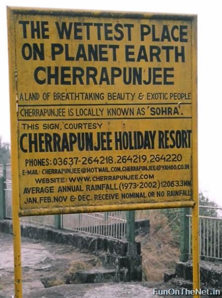
Cherrapunji (India): wettest place on Earth
Extreme Places
Cherrapunji, North-Eastern India is thought for many years to be the wettest place in the world. Here 10,820mm rain falls on average in a year. Unlike Colombia where the rain falls throughout the whole year, Cherrapunji gets most of its rain during the 'south-west monsoon', or wet season, between June and August. Cherrapunji does hold the record for the wettest month on record, recording 9,296mm in July 1861. Actually, between 1860 and 1862 Cherrapunji was incredibly wet; between August 1st 1860 and July 31st 1861 (which overlaps parts of 2 wet seasons) 26,467mm rain fell. In the calendar year 1861 22,987mm rain fell, of which 22,454 fell between April and September.
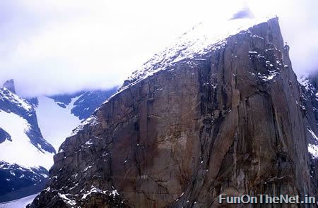
Mount Thor (Canada): Earth's greatest vertical drop
Extreme Places
Mount Thor, in Auyuittuq National Park on Baffin Island, Nunavut, Canada, presents a 4,100 foot pure vertical drop. Mt. Thor is Canada's most famous peak, and it's made of pure granite. It's a favorite of thrill seekers and climbers. Mount Thor was first climbed in 1953 by an Arctic Institute of North America team. There have been a few recent rappel expeditions, with one fatality in 2006. (Link)
Dead Sea (Jordan): Earth's lowest elevation at 1,385 ft (422 mt) below sea level
Extreme Places
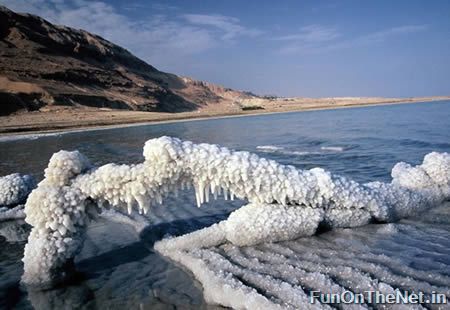
The Dead Sea is the lowest elevation on Earth's surface on dry land, its surface and shores are 422 meters (1,385 ft) below sea level. On the border of Jordan and Israel, the road around the Dead Sea also happens to be the lowest road on Earth. Famous for its salinity (over ten times that of the Mediterranean Sea), the Dead Sea is said to be home of the first health retreat. Because of the extreme salt content, no life can survive in the sea, hence the name. 

Saturday, October 24, 2009

Best Hotels of India

Hotels in India,Hotel India,Hotels India,India Hotel, India Hotels, Hotel in India,India Hotels,Hotels of India,Hotel of India,Indian Hotels, Luxury Hotels in India, Hotels in Goa, Hotels in Kerala, Hotels in Rajasthan, Hotels in Uttaranchal, Hotels in Agra, Hotels in Bangalore, Hotels in Bombay, Hotels in Chennai, Hotels in Delhi, Hotels in Hyderabad, Deluxe Hotels in India, Hotels in Jaipur, Hotels in Mumbai,Hotels in New Delhi, Hotels in Udaipur, Indian Hotels and Resorts, Indian hotels and resorts, Indian Odyssey

in reference to: Best India Hotels, Best India Hotels, Best Indian Hotels, Cheap Hotels in India, Deluxe Hotels in India, Best Hotels in India, Hotels Packages of India, India Hotels Packages, India online Hotels Booking, Hotels Booking in Indian, Hotels in Cities of India, Hotels in States of India, Luxury Hotels in India (view on Google Sidewiki)

All india hotels booking website launch-besthotelsofindia.in


Best Hotels of India| Hotels of Goa | Hotels of JK | Best Hotels of MP | Hotels of Pune | Best Hotels of Rajasthan | Hotels of Orissa | Hotels of Karnataka | Hotels of Westbengal | Hotels of Andhra | Hotels of Nagaland | Hotels of Tamilnadu | Hotels of Assam | Hotels of Kolkata | Hotels of Mumbai | Hotels of Arunachal | Hotels of Bangalore | Hotels of UP | Hotels of Punjab | Hotels of Lakshdweep | Best Hotels of Delhi | Hotels of Pondicherry | Hotels of Himachal | Hotels of Uttaranchal | Hotels of Chennai | Hotels of Chhattisgarh | Hotels of Hyderabad | Hotels of Kerala | Hotels of Andaman | Hotels of Gujarat | Discount Diamond Jewlery | Web Design Company